Suggested Price: $5.00
Description
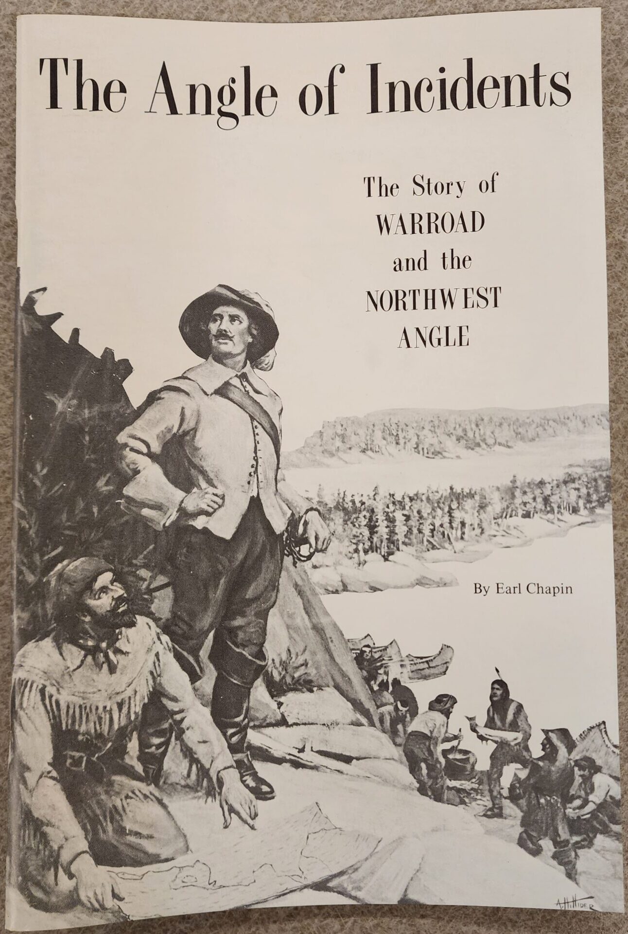
The Angle of Incidents
The Story of Warroad and the Northwest Angle
The AUTHOR of this book, Earl Chapin, is a Roseau County product. He was born in Badger and graduated from Roseau High School and the University of Minnesota. His experiences as editor and publisher of the Warroad Pioneer from 1937 to 1945 are recounted in his first book, “Long Wednesdays,” published in 1953. “Heavy Water,” a juvenile adventure-mystery, with setting on the Border chain of lakes and Lake of the Woods, followed in 1954.
Chapin has followed the profession of writing most of his life and has contributed hundreds of articles and short stories to nationally circulated magazines. One of his stories, “The Great Drop Game,” has become a children’s classic and currently appears in four American and one Canadian textbooks for English Junior High level, and in “Boy’s Life Treasury.”
For the past 18 years, Chapin has served as a feature writer, columnist, and photographer in Wisconsin for the St. Paul Pioneer Press in Minnesota.
Most of the material in this book was gathered under a Fellowship in Regional Writing granted Mr. Chapin by the University of Minnesota during the time he published the Warroad Pioneer.
Introduction:
The VILLAGE OF WARROAD is situated at the mouth of the Warroad River on Ka-Ka-Geesick Bay of the Lake of the Woods. It is the only American port on that vast body of inland water, largest save the Great Lakes, to touch upon in the United States.
As a white man’s village, the history of Warroad goes back to the 1890’s, but it is founded on the site of an Indian village which existed from the time of the coming of the Chippewas to this area just before the 18th century.
The name Warroad bespeaks the community’s Indian heritage – the war road ran from the Warroad River westward, following the gravel ridge that in prehistoric times was a shoreline of glacial Lake Agassiz. In the time of white settlement, this high and dry land route was known as the Summer Road in the eastern part of the county, and the Sandridge Trail from three miles beyond Roseau, westward.
For the Indians, the ridge was a convenient summer access to the prairie, and because in the early days possession of this land was disputed by the Sioux, the trail became known as the war road. The present site of Warroad was called Ka-Beck-a-Nung, End of the Trail.
End of the land trail Ka-Beck-a-Nung was, but it was also a portal to the great canoe route from Montreal and the Great Lakes, up to the border chain of lakes to the vast UP country of fur trade days. From the coming of Pierre de La Verendrye in 1732 until around 1875, the Lake of the Woods was a stage upon which many real-life dramas were enacted.
Warroad’s picture window looks out on the lake and the Northwest Angle, that peculiar piece of orphan land comprising about 435 square miles of mainland, island, and lake, cut off from the American mainland by water, and is surrounded on three sides by the Canadian Provinces of Ontario and Manitoba. It is the northernmost point in the United State, except Alaska.
While the Northwest Angle is politically a part of Lake of the Woods County, geographically it is contiguous to Warroad and bound to it by boat and the airlines operated for purposes of commercial and recreational transportation.
It is Warroad and the Northwest Angle, the “Angle of Incidents,” that is subject of this book.
Cost: $1
An additional $4.00 is included in the online price to cover shipping charges.
Related products
-
History of the Roseau County Schools – Junior Winter Sports Meets 1950-1970
Suggested Price: $14.00 Add to cart -

Tales – Life Story Interview Kit
Suggested Price: $48.00 Add to cart -
Sale!
Roseau County Heritage Book
Suggested Price: Original price was: $50.00.$35.00Current price is: $35.00. Read more -
P is for Pioneer, An ABC Picture Book
Suggested Price: $8.00 Add to cart